Exploring the variables that affect rainfall, such as temperature, humidity, wind patterns, and topography, can provide insights into why certain areas receive more or less rainfall than others.
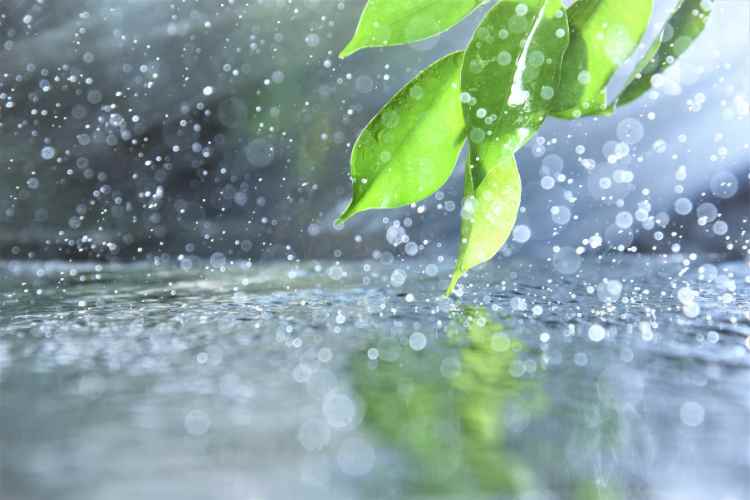
Rain is made up of water vapour droplets that have condensed from the atmosphere and have fallen due to gravity. Most of the freshwater that falls to the Earth as rainwater is deposited by rain, which is an important part of the water cycle. It offers irrigation for crops, water for hydroelectric power plants, and favorable environmental conditions for a variety of ecosystems. But do you also wonder why it rains more or less in certain areas?
So there are many factors that influence rainfall patterns in different regions. The key factors that influence rainfall in a particular region include prevailing winds, the existence of mountains, and seasons. Strong winds spread cool air or warm, humid air throughout the area. Where precipitation falls will depend on whether a mountain range is in the direction of the dominant winds. On the downwind or leeward side of a mountain, there are places with little rainfall. Precipitation is influenced by the seasons as well. Monsoons are large-scale, seasonally changing marine and land breezes.
In this article, we will thoroughly explain the factors that influence rainfall patterns along with answering your query on why certain areas receive more or less rainfall than others.
RELATED – What Might Happen If You Consume Contaminated Food and Water
Factors that Influence Rainfall Patterns
- Wind
Rain and other precipitation are carried by winds as they blow from water bodies to land. Dryness results from the contrary wind directions. As a result, whether or not it will rain or not in a particular place depends on the direction of the wind at that particular time. In places near mountains and hills, the wind’s direction also affects the amount of precipitation. This causes precipitation, and on the wind’s other side, known as the leeward side, there is dryness and low to no precipitation.
Higher evaporation is encouraged by faster wind speeds, which leads to deep convection. More rain follows as a result. The changes in evaporation brought on by an increase in wind speed are significantly outweighed by an increase in precipitation. Indicating a convergence cycle in which increased evaporation results in additional moisture, which feeds the quantity of precipitation.
- Temperature
The total hydrological cycle and rainfall patterns are significantly influenced by temperature. Warmer temperatures encourage evaporation, raising the atmospheric moisture content and increasing the likelihood of greater rainfall. Higher elevations of cooler air are encountered as the warm, humid air ascends, resulting in condensation and cloud formation. The stability of the atmosphere is also impacted by temperature changes with altitude, with greater temperatures in the lower atmosphere causing convective processes, the development of thunderstorms, and heavy rainfall.
Additionally, temperature gradients and variations in air masses have an impact on the development of weather systems that can have a larger-scale impact on rainfall distribution. The interaction between temperature, humidity, wind patterns, and air pressure makes temperature only one component of the puzzle. Since rising temperatures can result in changed precipitation patterns and more intense weather events, climate change further confuses the link between temperature and rainfall.
So, Studying and forecasting weather patterns and their possible effects on ecosystems and human cultures require a thorough understanding of the intricate interactions between temperature and rainfall.
- Humidity
Humidity is used to calculate how much water is in our atmosphere. Our experience of rainfall is also influenced by the amount of water vapour. This is because the amount of energy in the atmosphere and the presence of tiny particles for raindrops to form around are both necessary for rainfall.
The water vapour content controls the amount of rainfall during extremely strong downpours, in which all of the water in the sky is frequently soaked out. Higher humidity increases the likelihood of rain because water vapour expands more quickly. Because of this, tropical rain showers are frequently more strong and frequent than the showers that are more common in the UK. Therefore, humidity plays a crucial role in determining the strength of a rain shower or how comfortable a warm day is.
- Latitude
Latitude is a key factor in shaping the patterns of rainfall on Earth. In general, regions nearer the equator have more average rainfall. The Intertropical Convergence Zone (ITCZ), where warm, moist air rises, cools, and condenses to form clouds and precipitation, is the main cause of this. The equatorial rain belt is a result of the ITCZ. Additionally, the trade winds bring moisture from the oceans to coastal areas as they move from subtropical high-pressure zones towards the equator, which contributes to rainfall in some latitudes.
However, Latitude is not the only factor in determining rainfall patterns. Other variables include local terrain, regional topography, and global wind patterns. When wet air is pushed to rise and cool, for example, mountains can result in orographic rainfall, which causes rain to fall on the windward side and drier conditions on the leeward side. While latitude gives a rough idea of where rain will fall, it’s crucial to understand that there can be considerable changes and departures from regular patterns.
- Ocean current
Global patterns of rainfall are significantly influenced by ocean currents. These currents, which are influenced by variables including temperature gradients and wind patterns, are essential for controlling how moisture is distributed in the atmosphere. Warm ocean currents convey moist air from the tropics to higher latitudes, where the higher evaporation rates stimulate cloud formation and consequent rainfall. Coastal regions are cooled by cold ocean currents, which reduce evaporation and restrict rainfall.
Moreover, global weather patterns can be significantly altered by events like El Niño and La Niña, which are linked to variations in Pacific Ocean currents. While La Niña events can result in varying rainfall patterns, including enhanced or decreased rainfall in different locations, El Niño events can cause copious rainfall in some places and droughts in others.
Furthermore, upwelling brought on by ocean currents can boost productivity and affect regional rainfall in coastal locations. However, the complex network of atmospheric and oceanic processes must be understood that contribute to the determination of rainfall patterns. Examples include wind patterns, air pressure systems, and local topography.
- Topography
The topography also affects precipitation rates. A mountain range forces an air mass to rise. As it rises, it cools and the water molecules inside condense, a process known as adiabatic cooling. Precipitation is produced as a result of the condensation of water vapour into clouds and water droplets. Large volumes of precipitation fall on a mountain range’s windward side, which is exposed to wind and air masses. Consider Seattle, Washington as an example, which is situated on the windward side of the Cascade Mountains and has high levels of precipitation.
Leeward sides of mountain ranges typically get little precipitation compared to their windward counterparts because the moisture from the air masses passing over the mountains has been dropped on the range’s windward side. It is believed that mountain ranges’ leeward sides are in a “rain shadow.” Because of the terrain in the area, many regions east of the Rocky Mountains have little precipitation.
- Altitude
Rainfall frequency and intensity are strongly influenced by altitude in a particular area. The atmospheric pressure drops when air ascends to greater altitudes, which causes the temperature to drop. This procedure, known as adiabatic cooling, makes it easier for water vapor to condense and form clouds to develop. As a result, regions at higher altitudes typically experience an increase in cloud cover, which leads to more rainfall.
The orographic effect is another element that influences how much rain falls at different altitudes. Moist air is pushed to climb when it comes into contact with a mountain range, which causes it to chill and condense. As a result, the windward side of the mountain experiences more precipitation, while the leeward side of the mountain experiences a rain shadow effect with decreased precipitation because of the descending air mass.
Furthermore, rainfall patterns are influenced by atmospheric stability. Higher elevations frequently have less stable atmospheres, which encourages air to rise, boosting cloud formation and consequent rainfall. While altitude is an important component in determining where rain falls, it is also important to take other local characteristics into account because they can further affect precipitation patterns. These local factors include prevailing wind patterns, geographic position, and proximity to water bodies.
- Cloudiness
The development and occurrence of rainfall are significantly influenced by cloudiness. Moisture-rich air rises and cools, causing water vapour to condense into minute droplets or ice crystals, which is how clouds are created. The degree of cloudiness reveals the amount of moisture in the air, a necessary component for rainfall. Water droplets or ice crystals collide and combine within clouds to generate bigger particles. These particles fall as precipitation when they weigh too much to stay suspended. The number and size of these particles are influenced by cloud cover, which in turn affects the intensity and length of rainfall.
The amount of sky-obscuring clouds, or cloud cover, can be used to predict when it will rain. Since clouds block sunshine, encourage cooling, and contribute to the atmospheric instability required for rainfall, a higher cloud cover typically indicates a greater possibility of precipitation. Rainfall’s spatial distribution is also influenced by cloudiness; generally speaking, areas with greater cloud cover experience more widespread precipitation. Overall, cloudiness aids in understanding and predicting weather patterns by offering significant information about atmospheric conditions favorable to rainfall.
RELATED – What are FUE and FUT Hair Transplants?
- Pressure
Pressure changes daily at the Earth’s surface, which is at the base of the atmosphere. The Sun does not heat the Earth consistently, which contributes to this. Since heated air rises, low pressure is often found in these places. Low-pressure systems are the name for such areas. An area with high air pressure is called a high-pressure system.
Compared to its surroundings, a low-pressure system’s center has lower pressure. When winds blow in the direction of a low-pressure area, the air where they meet rises in the atmosphere. The water vapour in the air condenses as it rises, creating clouds and frequent precipitation. In a high-pressure system, the center experiences higher pressure than the surrounding regions. From areas of high pressure, winds blow. This is why it is typically simple to predict no rain when there is high pressure nearby. High pressure stops moisture from cooling and condensing into droplets by pushing down on air that is attempting to ascend near the surface.
- Distance from the sea
Rainfall patterns are significantly influenced by distance from the sea. Because there are more huge bodies of water nearby, coastal areas get more rain. When warm sea air reaches the colder land, it cools and condenses, causing clouds to develop and precipitation to fall. The moisture content is also increased by ocean evaporation. However, when the air travels away from the shore, rainfall decreases in inland places. The air becomes drier as a result of adiabatic cooling, which reduces the amount of precipitation. Additionally, rain shadows cast by mountains that impede winds carrying moisture can have an impact on inland areas. As a result, regional rainfall is substantially influenced by seaside location.
Why do certain areas receive more or less rainfall than others?
More rain falls in certain places than in others. This might be a result of the proximity to mountains, the amount of water nearby, and the wind’s direction.
Moreover, depending on the climate of a given area, some locations experience more rain than others. When a cloud rises, the atmospheric pressure in the area drops, causing the cloud to expand and cool. Water vapour condenses on the cloud droplets as the parcel cools, increasing their size. They fall like rain when they become too big for the updraft to support them. As a result, it rains more frequently and strongly during strong updrafts in areas where air rises more regularly.
Precipitation rates fluctuate over time and across the globe. Everywhere in the world, rain doesn’t fall in the same amount. Different rainfall patterns can occur for a variety of reasons:
- Desert regions receive sinking, dry air from high-pressure systems, which is why they receive little rainfall (the majority are between 15° and 35° north and south of the equator).
- The interiors of huge continents tend to be dry because of their distance from sources of moisture and the fact that many clouds lose moisture before they can reach the continent’s center. This is best exemplified in Central North America.
- Polar regions are dry because warm air can contain more moisture than cold air, hence precipitation can’t happen as frequently there.
- Regions close to the equator have high quantities of rainfall due to severe temperatures from continuous solar radiation, broad evaporation, and moist ascending air that cools with height to generate convectional rainfall. Intense rains are also produced here by the convergence of air masses.
- Mid-latitudes may experience convectional precipitation, and frontal (or depressional) precipitation comes from the convergence of polar and sub-tropical air masses. This happens when warm, moist air is forced to rise above colder, denser air, which causes it to cool.
- Due to uplift, mountain ranges close to water sources may experience heavy precipitation. When clouds rise to pass over mountains, the air cools, encouraging the water molecules to combine, resulting in precipitation. This phenomenon, known as relief orographic precipitation, explains why many uplands receive more precipitation than comparably situated lowlands. Additionally, this may cause precipitation to abruptly decrease in areas behind (downwind of) the mountains. The rainshadow effect is a typical name for this phenomenon.
Global precipitation patterns could be significantly impacted by future climate change. Increased evaporation may cause a rise in precipitation in some regions, whereas areas that currently receive regular rainfall may experience a decrease.
RELATED – Heart Screening in Singapore: Frequently Asked Questions
FAQs:
What are the main factors that influence rainfall patterns?
The main factors include temperature, humidity, wind patterns, air pressure, topography, and proximity to water bodies.
How does temperature affect rainfall?
Higher temperatures increase evaporation, leading to more moisture in the air and, ultimately, more rainfall.
What role does humidity play in rainfall?
High humidity means the air holds more water vapor, which can condense into clouds and result in precipitation.
How do wind patterns influence rainfall?
Winds carry moisture from oceans to land. Monsoon and trade winds often bring seasonal rainfall to certain regions.
Does altitude or topography affect rainfall?
Yes. Mountains force moist air to rise and cool, causing rain on the windward side and dry conditions on the leeward side (rain shadow effect).
How do oceans and seas impact rainfall?
Areas near large water bodies usually receive more rainfall because of the constant evaporation and moisture supply.
Can human activities influence rainfall patterns?
Yes. Urbanization, deforestation, and climate change can alter local rainfall by affecting heat absorption, moisture, and wind flow.
How does climate change affect global rainfall patterns?
Climate change intensifies rainfall in some areas and causes droughts in others by disrupting temperature and wind systems.
Conclusion
Human life depends on rain as it is the source of fresh water. Rain supports modern life by supplying water for hygienic purposes, industry, agriculture, and electrical energy. For private and public use, governments, organizations, and people all gather rain. Air temperature, moisture-carrying winds, ocean currents, distance from the sea and mountain ranges all play a role in how much rain falls on the earth’s surface. So overall, we have thoroughly explained the factors that influence rainfall patterns and why certain areas receive more or less rainfall than others. We hope you found this article worth reading and now you have understood the complete concept of what affects rain.